|
Bali, Indonesia (ESA) Dec 14, 2007 The role of Earth Observation satellites in combating climate change is being highlighted at the United Nations climate change conference where thousands of delegates from more than 180 countries are gathered to begin negotiations of an international emissions-cutting agreement to succeed the Kyoto Protocol, whose first commitment period ends in 2012. The Protocol commits its signatories to reduce levels of greenhouse gases - chief among them carbon dioxide - believed to be increasing global warming. Around 25 billion tonnes of extra carbon dioxide is released into the atmosphere annually by human activities, mainly through burning of fossil fuels, land clearance and wildfires. Because deforestation in tropical rainforests accounts for as much as 20 percent of global greenhouse gas emissions, finding ways to curb or halt deforestation is high on the conference's agenda. One scheme under consideration, called Reduced Emissions from Deforestation in Developing Countries (REDD), involves developed countries offsetting their emissions by paying developing countries for every hectare of forest they do not cut down. In order for the carbon-accounting scheme to work, systematic monitoring of forests is crucial, with tropical deforestation as a major contributor.
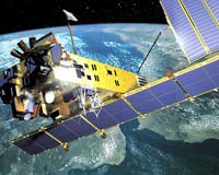
EO monitoring However, tropical rainforests are notorious for persistent cloud cover, which prevents traditional satellite sensors from making regular acquisitions. Satellite radar sensors flown aboard ESA's Envisat and ERS satellites are able to produce reliable high-quality images of these areas because they are able to peer through clouds, haze and smoke. Using Envisat's Advanced Synthetic Aperture Radar (ASAR) sensor, an automated satellite radar monitoring application for deforestation detection has been developed by SarVision, a spin-off of Wageningen University in the Netherlands and the Indonesian Ministry of Forestry. The application, which has been implemented in the extensive peat swamp forests of Central Kalimantan, Indonesia, has played an important role in establishing the first REDD initiative generating carbon credits from the conservation of peat swamps. Peat swamp forests store large quantities of carbon in the ground, resulting in them releasing large amounts of greenhouse gases from deforestation and fires. Envisat is providing a new ASAR acquisition of the same peat land area (6 000 000 hectares) every 35 days - timely enough for local partners to effectively deploy law enforcement or to inform policy makers. Local partners on the ground confirm clearings and burnt areas by regularly targeted field surveys and ultra light aircraft. The change maps, available to users online in Google Earth, are easy to grasp even for an untrained eye. Remote Sensing Solutions GmbH (RSS) of Germany is also using EO satellites to monitor land cover change and the impact of fires in tropical peat lands and emissions of carbon dioxide emissions caused by peat fires and peat decomposition. The company uses Envisat's ASAR, in combination with optical sensors, to improve biomass estimates of pristine and degraded forest ecosystems for REDD baseline assessment and monitoring. According to Professor Florian Siegert, CEO of RSS, the large increase in area of oil palm on peat that is projected to take place in coming years to satisfy the biofuel demand will release much more carbon dioxide emissions than the fossil fuel it is supposed to replace. Rudy Rabbinge, Dean of Wageningen University, expressed concerns at the UNFCCC Forest Day saying it is "unwise to go in big scale on biofuel in developing countries." Dr Susan Page of the Department of Geography, University of Leicester, involved in the EU-funded CARBOPEAT and RESTORPEAT projects said: "Current land use and land practice developments in Southeast Asia give grave cause for concern. While deforestation rates in non-peatland areas are decreasing slightly owing to depletion of forest resources, those on peatlands have been rising for the last 20 years. "In 2005, 25 percent of all deforestation in Southeast Asia was on peatlands owing to demand for land on which to establish plantations. Current UNFCCC negotiations in Bali on REDD could offer a crucial opportunity to reduce carbon emissions from tropical peatlands and thus contribute to combating global climate change."
ESA participation On Thursday, ESA hosted a special side event, 'Space supporting UNFCCC - global products for a better understanding of our climate,' which covered global aspects for monitoring essential climate-variables (ECV) and sought to illustrate EO as a feasible and practical tool for climate change observation. With support from ESA, the Global Observation of Forest and Land Cover Dynamics (GOFC-GOLD) and the Joint Research Centre (JRC) presented their REDD sourcebook providing guidelines for implementation mechanisms. In the future, even better tools from space to monitor tropical deforestation will be available through the EU-led initiative Global Monitoring for Environment and Security (GMES), which from 2011 will begin launching the Sentinel satellites that will enable operational monitoring. Related Links Observing the Earth Climate Science News - Modeling, Mitigation Adaptation
 San Francisco CA (SPX) Dec 13, 2007
New findings from NASA's CloudSat and other spacecraft in NASA's "A-Train" constellation of five Earth observing satellites offer important insights into this year's record reduction of Arctic sea ice, global rainfall patterns and the effects of pollution on clouds. The investigations are giving scientists a greater understanding of factors influencing Earth's present climate and an important foundation for better understanding long-term climate change. |
|
| The content herein, unless otherwise known to be public domain, are Copyright Space.TV Corporation. AFP and UPI Wire Stories are copyright Agence France-Presse and United Press International. ESA Portal Reports are copyright European Space Agency. All NASA sourced material is public domain. Additional copyrights may apply in whole or part to other bona fide parties. Advertising does not imply endorsement, agreement or approval of any opinions, statements or information provided by Space.TV Corp on any Web page published or hosted by Space.TV Corp. Privacy Statement |