 |
Miami (AFP) May 22, 2007 As many as 10 hurricanes could form in the Atlantic Ocean this year, including five that could become major hurricanes, US forecasters said on Tuesday. In all, 13 to 17 named storms are expected to form during the six-month Atlantic hurricane season that starts on June 1, according to the National Oceanic and Atmospheric Administration (NOAA.) Seven to 10 of the storms could become hurricanes, including three to five that could reach at least category three on the five-level Saffir-Simpson scale, meaning they would pack sustained winds of at least 178 kilometers (111 miles) per hour. The experts urged people living in hurricane-prone regions to ensure they are ready for what is expected to be an active storm season. "Now is the time to update your hurricane plan, not when the storm is bearing down on you," said Bill Proenza, who heads the Miami-based National Hurricane Center. Last month, experts at the University of Colorado also predicted 17 named storms would form during the upcoming season, and said they expected nine of them to strengthen into hurricanes. Philip Klotzbach and William Gray also said there was a 74 percent likelihood of an Atlantic hurricane hitting the United States this year. The level of storm activity will depend in part on whether the weather phenomenon known La Nina does develop and how strong it will be. "If La Nina develops, storm activity will likely be in the upper end of the predicted range, or perhaps even higher depending on how strong La Nina becomes," said Gerry Bell, the lead hurricane forecaster at the Climate Prediction Center. Last year saw the formation of the opposite phenomenon, known as El Nino, which created a hostile environment for the formation of Atlantic storms. Nine storms formed in 2006, including five hurricanes, which did relatively little damage. El Nino, which warms Pacific waters, tends to lead to a strengthening of westerly upper level winds that disrupt tropical cyclones. During La Nina, which cools Pacific waters, the westerly winds weaken, allowing hurricanes to form, and strengthen. Bell stressed, though, that "even if La Nina does not develop, the conditions associated with the ongoing active hurricane era still favor an above-normal season." Weather experts believe the generally busy Atlantic storm seasons since 1995 are part of a historic cycle that alternates between decades of intense activity and of relative calm. Several records were set in 2005, when 28 storms formed, 15 of them hurricanes. That year, Hurricane Stan killed some 2,000 people in Guatemala and Katrina, hit the US Gulf coast, flooding much of New Orleans and killing about 1,500 people.
Source: Agence France-Presse Related Links the missing link Bringing Order To A World Of Disasters When the Earth Quakes A world of storm and tempest
 Boulder CO (SPX) May 22, 2007
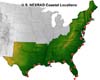
Forecasters will test a new technique this summer that provides a detailed 3-D view of an approaching hurricane every six minutes and allows them to determine whether the storm is gathering strength as it nears land. The technique, developed by researchers at the National Center for Atmospheric Research (NCAR) and the Naval Research Laboratory (NRL), relies on the existing network of Doppler radars along the Southeast coast to closely monitor hurricane winds. |
|
| The content herein, unless otherwise known to be public domain, are Copyright Space.TV Corporation. AFP and UPI Wire Stories are copyright Agence France-Presse and United Press International. ESA Portal Reports are copyright European Space Agency. All NASA sourced material is public domain. Additional copyrights may apply in whole or part to other bona fide parties. Advertising does not imply endorsement, agreement or approval of any opinions, statements or information provided by Space.TV Corp on any Web page published or hosted by Space.TV Corp. Privacy Statement |

