 |
Paris (ESA) May 19, 2011 ESA is helping to take the bite out of mosquitoes and their deadly diseases by tracking their distribution and habitat via observation satellites, satnav, and mobile communications. The Vecmap initiative is testing the accurate mapping of mosquitoes in Europe, in particular, mosquitoes carrying diseases, for public health agencies and regional mosquito controllers. Testing began in 2009 in the Netherlands, the UK, Belgium, France, Switzerland and Italy. Transmitters of disease such as mosquitoes are known as vectors. With this information, the insects can be kept below the level where they become a nuisance or able to spread disease. "Diseases such as Dengue or West Nile fever that are carried by mosquito vectors are an increasing public health concern in many European countries, yet very little is known about the distribution of either the diseases or the vectors that transmit them to humans," says Michiel Kruijff, ESA's technical officer. "There is a clear need for maps showing where mosquitoes have been detected, where they could be and when the population will peak." Vecmap is now being refined and is planned to be tested further by users in several European countries during the next two summer seasons before it is marketed commercially. Predicting mosquito presence, abundance and risks is difficult. The conditions, location and timing of hatching vary widely between species. Highly detailed and frequent information on the local environment and weather conditions are required. ESA has enabled three companies to join forces in developing Vecmap, who are now working closely with future users. Users are being coordinated by The Dutch National Institute for Public Health and the Environment (RIVM). Vecmap addresses the problem by integrating the entire process of producing risk maps into a single package that can be used by a wide range of practitioners. "It literally is a one-stop-shop for vector mapping," says Dr Marieta Braks, a medical entomologist at RIVM. Vecmap combines inputs from field work and Earth observation satellites such as vegetation, land temperature, moisture and water bodies. The field measurements are entered into a palm-to-web terminal or smart phone, which pinpoints them using satnav. Then they are transferred to a central database. In this way, the field work can be done effectively and independently. The consortium is led by Avia-GIS (BE), a company specialising in spatial risk management, and includes ERGO (GB), MEDES (FR) as developing partners; VITO (BE) and EARS (NL) which provide remote sensing imagery; and RIVM which represents the user community.
Share This Article With Planet Earth
Related Links Telecommunications and Integrated Applications and ESA Vecmap Earth Observation News - Suppiliers, Technology and Application
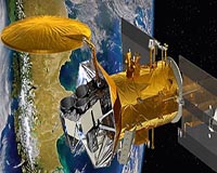 NASA Mission Will Observe Earth's Salty Seas
Pasadena CA (SPX) May 18, 2011 Final preparations are under way for the June 9 launch of the international Aquarius/SAC-D observatory. The mission's primary instrument, Aquarius, will study interactions between ocean circulation, the water cycle and climate by measuring ocean surface salinity. Engineers at Vandenberg Air Force Base in California are performing final tests before mating Aquarius/SAC-D to its Delta II roc ... read more |
|
| The content herein, unless otherwise known to be public domain, are Copyright 1995-2010 - SpaceDaily. AFP and UPI Wire Stories are copyright Agence France-Presse and United Press International. ESA Portal Reports are copyright European Space Agency. All NASA sourced material is public domain. Additional copyrights may apply in whole or part to other bona fide parties. Advertising does not imply endorsement,agreement or approval of any opinions, statements or information provided by SpaceDaily on any Web page published or hosted by SpaceDaily. Privacy Statement |


 del.icio.us
 Digg
Digg Reddit
 YahooMyWeb
 Google