 |
Montreal (AFP) Aug 29, 2010 A high-tech expedition has been forced to suspend its efforts to create a detailed map of the wreckage of the Titanic because of the approach of Hurricane Danielle. "It's official. Hurricane Danielle will force us to temporarily halt operations at the wreck site as of early Sunday morning," American group RMS Titanic, which holds exploration rights for the wreck, wrote on its Facebook page late Saturday. "The team is working through the night to complete as many mission objectives as possible. To ensure the safety of all on board, we are heading back to St. John's, Newfoundland for a few days," the expedition leaders wrote, adding that they would return to the venue "once the storm has passed to complete our goals." Danielle never made landfall but reached Category Four strength Friday. Now a Category One storm, it continues to weaken as it sails towards open waters of the north Atlantic. The high tech expedition began work earlier this month to explore the ocean floor where the ship sank nearly one hundred years ago, the crew said Thursday. Sonar onboard an automated submersible vehicle combined with high-resolution video will be used to create three dimensional images of the fabled oceanliner. The expedition arrived last week aboard the scientific vessel Jean Charcot and started by laying flowers on the water's surface to commemorate the 1,500 victims of the shipwreck. The team of experts said they will be using some of the most advanced technology available to create a portrait of the ship unlike any that has been created before "virtually raising the Titanic," and posting images from their mission at the website www.expeditiontitanic.com. The Titanic, a luxury passenger ship once thought to be unsinkable, hit an iceberg on April 14, 1912 and sank in the early morning of April 15, 1912, killing 1,500 people. After decades of searching, the wreckage of the Titanic was discovered in 1985 some four kilometers (2.5 miles) beneath the surface of the sea.
Share This Article With Planet Earth
Related Links Bringing Order To A World Of Disasters When the Earth Quakes A world of storm and tempest
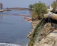 Doubts over bid to protect New Orleans from more Katrinas
New Orleans, Louisiana (AFP) Aug 26, 2010 As the fifth anniversary of Hurricane Katrina looms, the noise of jackhammers, pile drivers and large-scale construction is as ever-present as the sound of New Orleans jazz or cicadas singing in Louisiana's August sun. With a remarkable string of projects under way, totaling close to 15 billion dollars, the US Army Corps of Engineers is trying to protect the region from ever suffering such d ... read more |
|
| The content herein, unless otherwise known to be public domain, are Copyright 1995-2010 - SpaceDaily. AFP and UPI Wire Stories are copyright Agence France-Presse and United Press International. ESA Portal Reports are copyright European Space Agency. All NASA sourced material is public domain. Additional copyrights may apply in whole or part to other bona fide parties. Advertising does not imply endorsement,agreement or approval of any opinions, statements or information provided by SpaceDaily on any Web page published or hosted by SpaceDaily. Privacy Statement |


 del.icio.us
 Digg
Digg Reddit
 YahooMyWeb
 Google