 |
Guildford UK (SPX) Jan 12, 2009 Canadian precision agriculture supplier and consultancy DynAgra has completed its first precision agriculture campaign using DMCii satellite imagery to provide sophisticated agronomic tools to its customers. DynAgra tasked DMCii with acquiring multi-spectral imagery of agricultural plots in the province of Alberta. DMCii provided the imagery in an accurately orthorectified format that could be used immediately in their Geographical Information System (GIS) applications. Alex Melnitchouck, Senior Research Agronomist explained his reasons for working with DMCii, "For us it was important to have a responsive partner. DMCii were able to acquire cloud free imagery of the target areas during the very brief 2-3 week summer growing season in Western Canada." DMCii is in the unique position of having an operational constellation of 5 satellites, each of which is able to image a very large area in a given timeframe as the very wide swath images acquired offer daily revisit to global targets. Owen Hawkins, Business Development Manager, DMCii explained the advantage of constellation imaging, "The Disaster Monitoring Constellation enables us to image very large areas in a short period of time, by coordinating the satellites we can provide daily revisit to an area. This is a big advantage when conducting such a time sensitive remote sensing campaign and offers significant commercial and technical advantages to our customers." Agronomy service providers are experiencing growing demand for precision agriculture tools and services. This is driven mainly by increasing fertiliser costs and crop prices, and growers increasing awareness that investment in simple technical tools can result in significant cost efficiencies, whilst improving crop output. DynAgra uses the imagery from DMCii along with crop models to produce maps showing the density of green biomass. The company's experts then work with the farmer to map out management zones within the fields. The management zones are then further investigated by DynAgra's highly skilled team of agronomists and remote sensing engineers using GPS-enabled Personal Digital Assistants (PDAs) to locate the management zones and record additional information about the concentration of nitrogen, phosphorus, potassium, soil organic matter, pH and other soil characteristics. Once the required information has been compiled, DynAgra produces a geographically referenced fertiliser application map for farmers describing which fertiliser should be used, where and in what quantity. About DMC International Imaging Ltd DMC International Imaging Ltd (DMCii) is a UK based supplier of remote sensing data products and services for international Earth Observation (EO) markets. DMCii supplies programmed and archived optical satellite imagery provided by the multi-satellite Disaster Monitoring Constellation (DMC). DMC data is now used in a wide variety of commercial and government applications including agriculture, forestry and environmental mapping. In partnership with the British National Space Centre (BNSC) and the other DMC member nations (Algeria, China, Nigeria, Turkey and Spain), DMCii works with the International Charter: 'Space and Major Disasters' to provide free satellite imagery for humanitarian use in the event of major international disasters such as tsunami, hurricanes, fires and flooding. DMCii was formed in October 2004 and is a subsidiary of Surrey Satellite Technology Ltd, the world leader in small satellite technology. SSTL designed and built the DMC with the support of the BNSC and in conjunction with the DMC member nations Algeria, China, Nigeria, Turkey and Spain. Related Links DMCii Earth Observation News - Suppiliers, Technology and Application
 Kuala Lumpur (AFP) Dec 28, 2008
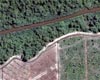
Malaysia is zooming in on forests with a satellite in order to fight illegal logging which its government says is harming the major timber exporting country, a report said Sunday. |
|
| The content herein, unless otherwise known to be public domain, are Copyright Space.TV Corporation. AFP and UPI Wire Stories are copyright Agence France-Presse and United Press International. ESA Portal Reports are copyright European Space Agency. All NASA sourced material is public domain. Additional copyrights may apply in whole or part to other bona fide parties. Advertising does not imply endorsement, agreement or approval of any opinions, statements or information provided by Space.TV Corp on any Web page published or hosted by Space.TV Corp. Privacy Statement |

