 |
Redlands CA (SPX) May 05, 2009 ArcGIS 9.3.1 helps you create and share modern Web maps that are relevant to your entire organization. This release of ESRI's integrated collection of geographic information system (GIS) software products focuses on improving the performance of dynamic map publishing and increasing the visibility of geographic information.
High-Performance Dynamic Map Publishing ArcGIS Desktop users can fine-tune their maps for faster performance using the new Map Service Publishing toolbar. The toolbar allows maps to be analyzed and makes recommendations for fine-tuning. The results can be previewed, and estimated draw times are provided. Maps can now be published directly from the ArcGIS Desktop ArcMap application to ArcGIS Server. Optimized map services also improve map caching performance, as faster rendering speeds reduce the time it takes to create map caches for basemaps. Map quality is noticeably improved, and storage is more efficient. These new map services outperform equivalent ArcIMS services and provide significantly better-looking maps, benefiting those who use dynamic Web mapping or combine dynamic and cached maps on the Web.
Better Sharing of Geographic Information ArcGIS Online includes a new application in which users can create an account and, through a keyword search, find content; preview it; and, with a simple click, add it to ArcMap or ArcGIS Explorer. To facilitate the sharing of layers in ArcGIS, users can create layer packages that encapsulate ArcMap cartography and data, including a thumbnail, the extent, and spatial reference, in an easy-to-share package. Layer packages can be shared via ArcGIS Online as files, attached to e-mails, or included on DVDs. Joining the ArcGIS Online user community is easy and free to all ArcGIS users.
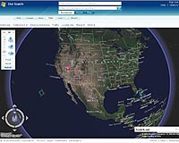
Seamless Integration with Microsoft Virtual Earth Virtual Earth imagery and street maps provide excellent background maps on which users can overlay their operational data. Also, ArcGIS Explorer users and ArcGIS Server developers who are using Microsoft Silverlight, Flex, JavaScript, Java, or .NET now have simple access to the same high-quality Microsoft Virtual Earth basemap data.
ArcGIS API for Microsoft Silverlight The new ArcGIS API for Microsoft Silverlight allows developers to use any .NET Framework-supported language to add GIS capabilities and consume services from ArcGIS Server and Microsoft Virtual Earth in a Silverlight application. The API takes full advantage of the mapping, geocoding geometry, image, and geoprocessing capabilities of ArcGIS Server. End users can display their data in an interactive map, search for and display GIS data features and attributes, locate addresses, identify features, access raster imagery, and perform complex spatial analysis by simply clicking a button or feature on the map. Share This Article With Planet Earth
Related Links ESRI GPS Applications, Technology and Suppliers
 Glenview IL (SPX) Apr 24, 2009
Navman Wireless North America announced today that its OnlineAVL2 vehicle tracking and logistics system now has the ability to pinpoint vehicles that are being underused, based on travel distance and ignition time thresholds set by the fleet manager. |
|
| The content herein, unless otherwise known to be public domain, are Copyright 1995-2007 - SpaceDaily.AFP and UPI Wire Stories are copyright Agence France-Presse and United Press International. ESA Portal Reports are copyright European Space Agency. All NASA sourced material is public domain. Additional copyrights may apply in whole or part to other bona fide parties. Advertising does not imply endorsement,agreement or approval of any opinions, statements or information provided by SpaceDaily on any Web page published or hosted by SpaceDaily. Privacy Statement |
 del.icio.us
 Digg
Digg Reddit
 YahooMyWeb
 Google